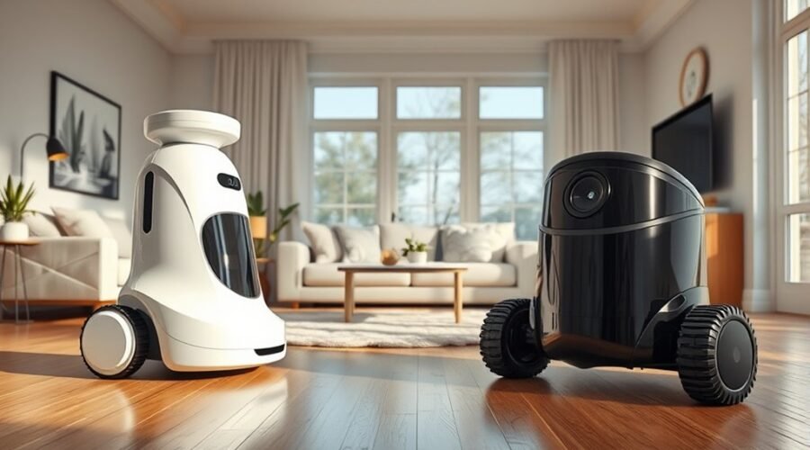
LiDAR and camera navigation define two different approaches to robot vacuum mapping. LiDAR relies on laser-based distance measurement, usually delivering stronger accuracy in darkness and cluttered spaces. Camera systems depend on visual features, which can improve cost efficiency but reduce reliability in low light or sparse rooms. The real tradeoff is not simple performance alone. It involves environment, privacy, and speed, and the practical outcome is often less obvious than it first appears.
Which Is Better: LiDAR or Camera Robot Vacuums?
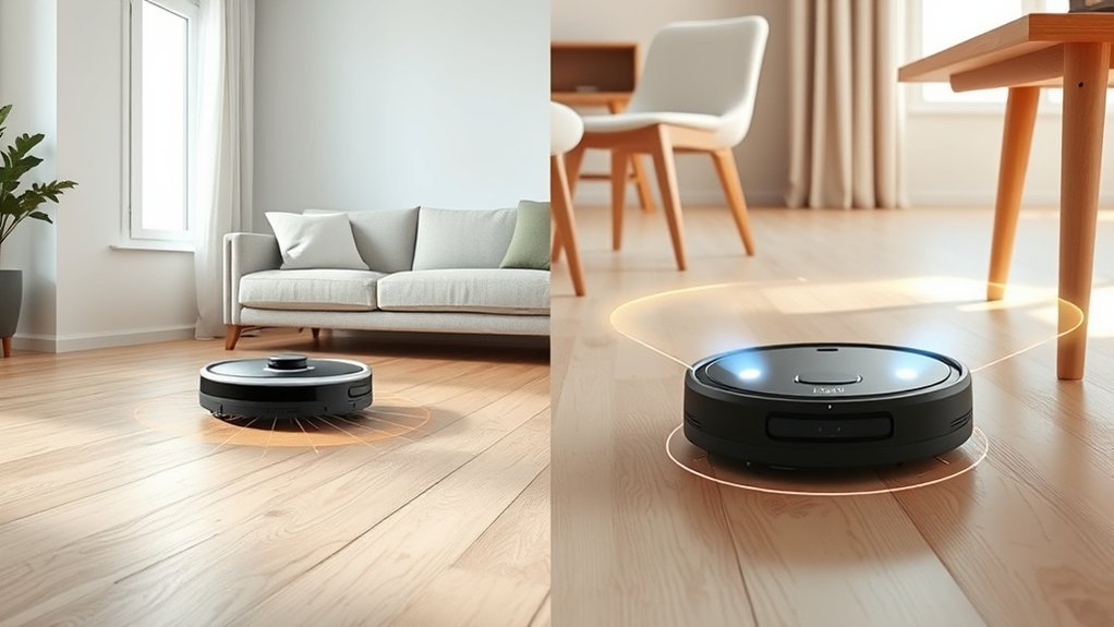
Choosing between LiDAR and camera robot vacuums depends on the cleaning environment and performance priorities.
LiDAR generally delivers superior navigation and accuracy, with millimeter-level mapping that supports complex layouts and predictable paths. It remains effective across lighting conditions, including darkness, which grants robot vacuums operational independence from ambient light.
Camera systems, by contrast, rely on visual data; they can improve object detection by reading shapes and features, yet accuracy may fall sharply in low light, reducing reliability by as much as 40%.
Camera-based models usually cost less, making them accessible entry points, but cost differences reflect reduced sensing robustness. LiDAR units often command higher prices because of advanced hardware.
For many households, hybrid models offer the most balanced option, combining LiDAR and camera capabilities to strengthen navigation and obstacle avoidance.
The better choice is consequently contextual: LiDAR for precision and autonomy, camera for affordability, and hybrids for broader performance.
How LiDAR Robot Vacuums Map Your Home
LiDAR robot vacuums map a home by emitting laser pulses and measuring the return time from surrounding surfaces, building a detailed spatial model of walls, furniture, and open floor areas.
This LiDAR technology produces high mapping accuracy, often exceeding 95%, even in darkness, giving robot vacuums a reliable internal blueprint independent of ambient light.
The system uses Simultaneous Localization and Mapping to determine position while updating the map, so navigation remains stable as obstacles shift or new objects appear.
Because the laser pulses measure distance directly, the vacuum can distinguish boundaries, corridors, and furniture edges with precision.
Direct laser measurements let the vacuum distinguish walls, corridors, and furniture edges with precision.
That data supports faster route planning, enabling more efficient cleaning across large, complex spaces.
In practice, the result is more autonomous coverage, fewer missed zones, and stronger operational freedom from lighting constraints.
LiDAR thus functions as a high-speed sensing and control technology that turns uncertain rooms into legible environments for systematic cleaning.
How Camera-Based vSLAM Works
Camera-based vSLAM identifies visual landmarks from captured images to estimate the vacuum’s position and construct an indoor map.
The mapping process updates continuously as new frames are processed, allowing the system to adapt to moved objects and changing room layouts. Its performance depends strongly on adequate lighting and feature-rich scenes, since weak illumination and sparse visual detail reduce tracking accuracy.
Visual Landmark Detection
Visual landmark detection in camera-based vSLAM depends on continuously capturing images and matching fixed features such as furniture, walls, and other distinctive objects to estimate the robot’s position and build a map of the room. In LiDAR comparison, the camera relies on visual landmarks for navigation, mapping, and obstacle detection, while depth perception remains less direct.
| Factor | Effect | Note |
|---|---|---|
| Lighting | Strong | Best under bright conditions |
| Visual landmarks | High value | Improves positional certainty |
| Cluttered rooms | Effective | Rich cues support vSLAM |
When lighting declines, accuracy may drop sharply, reducing reliable guidance by up to 40%. Feature-rich interiors consequently favor camera-based navigation, yet tight spaces can still expose depth perception limits. For users seeking autonomy from expensive sensors, vSLAM offers a practical route, though LiDAR remains more robust in dim, constrained environments.
Real-Time Map Updates
As it moves, the robot continuously captures images and updates its map in real time by matching fixed visual landmarks such as furniture edges, walls, and other distinctive objects.
In vSLAM, these observations support visual recognition and triangulation, allowing navigation systems to refine position estimates without LiDAR. The result is real-time maps that change as the vacuum enters new rooms or encounters relocated obstacles, preserving accurate navigation across the environment.
This dynamic updating helps the machine adjust cleaning routes quickly, often faster than LiDAR-based methods. Yet the system depends on enough stable features for reliable tracking; when the environment becomes cluttered or sparse, precision can decline.
Even so, camera-based updates offer a flexible, technically efficient path toward autonomous movement and expanded household freedom.
Lighting And Feature Needs
When adequate illumination and distinctive environmental features are present, vSLAM can build and refine a navigation map by identifying fixed landmarks such as furniture edges, walls, and other high-contrast objects.
In camera systems, vSLAM navigation depends on visual features for accurate mapping, so feature-rich areas improve positional certainty and route stability.
In low-light conditions, recognition drops sharply, and accuracy can decline by up to 40%, increasing navigation errors.
The method also faces limits in depth perception, especially in cluttered or narrow spaces where object separation is ambiguous.
Compared with LiDAR, camera-based units require brighter environments to operate reliably, which constrains use during nighttime cleaning or in dark rooms.
Their strength lies in visible detail; their weakness is dependence on light, texture, and stable visual cues.
Which Is More Accurate: LiDAR or Camera?
LiDAR generally delivers higher mapping precision, often exceeding 95% accuracy through laser-based distance measurement with millimeter-level resolution.
Camera systems can be highly effective in bright, feature-rich spaces, but their accuracy typically degrades in low light, where performance may drop considerably.
For obstacle detection, cameras can better classify small objects such as cables and toys, while LiDAR offers more consistent navigation accuracy across varied environments.
Mapping Precision
Mapping precision is where the distinction between LiDAR and camera-based navigation becomes most pronounced. LiDAR delivers superior mapping accuracy through laser pulses that measure distance with millimeter-level precision, producing reliable 3D maps for complex floor plans and multi-level homes. This enables robot vacuums to move with disciplined certainty and fewer navigation errors.
Camera-based systems depend on visual recognition, which reduces depth perception and can introduce errors in tight or cluttered spaces. Their precision is strongest when visual features are abundant, yet it weakens when scenes become less structured.
For users seeking autonomy from repeated correction, LiDAR offers a more exact spatial model. Camera systems remain functional, but their mapping accuracy is less consistent than LiDAR, especially when environmental detail is limited.
Low-Light Accuracy
In dim environments, LiDAR retains a clear advantage in accuracy because it uses laser pulses to measure distance independently of ambient light, maintaining over 95% mapping precision even in complete darkness.
This low-light accuracy supports dependable navigation where a camera can lose up to 40% of its performance in dim lighting, since visual localization depends on available illumination.
LiDAR consequently preserves efficient mapping and produces detailed 3D maps with minimal degradation, even in shadowed rooms or under furniture.
Camera systems can remain useful in well-lit spaces, but their accuracy falls as light declines, limiting consistency.
For users seeking liberation from lighting constraints, LiDAR offers the more autonomous solution, combining stable navigation, reliable obstacle avoidance, and higher precision in environments that do not cooperate with visibility.
Obstacle Detection
Obstacle detection accuracy generally favors LiDAR because its millimeter-level distance measurements and 360° scanning provide consistent obstacle awareness across lighting conditions, including complete darkness. In robot vacuums, this navigation technology supports precise mapping and fewer collisions.
- LiDAR maintains high accuracy in low-light environments.
- Camera systems can lose up to 40% accuracy when light is poor.
- Cameras still classify objects well in bright, textured rooms.
- LiDAR improves obstacle detection by reducing missed edges and furniture.
- Hybrid systems combine LiDAR and camera strengths for broader coverage.
For home layouts demanding reliable autonomy, LiDAR offers stronger obstacle detection performance, while camera-based navigation remains useful for recognition.
Hybrid systems deliver the most balanced result, pairing measurement precision with visual categorization, and expanding the practical freedom robot vacuums can achieve.
How Do They Perform in Dark Rooms?
When the lights go out, LiDAR robot vacuums continue to map and navigate with high accuracy because laser pulses measure distances independently of ambient light, enabling precise 3D mapping and reliable movement in complete darkness.
In dark rooms, LiDAR preserves mapping accuracy, supports stable navigation, and sustains consistent performance for robot vacuums without dependence on illumination.
Camera systems, by contrast, require visible landmarks for object recognition and route calculation; in low-light conditions, their performance can degrade sharply, with accuracy falling by as much as 40% when lighting is insufficient.
This dependence limits camera-based navigation in unlit spaces and makes dark rooms a hostile environment for their sensors.
LiDAR consequently offers a clearer technical advantage for homes that demand autonomous cleaning at any hour, while camera-based designs remain better aligned with well-lit settings where visual data is abundant and dependable.
Which Handles Clutter Better?
Cluttered interiors shift the comparison from lighting conditions to obstacle recognition, where camera-based navigation often has an advantage. In clutter, a camera can classify toys, cords, and furniture edges with real-time visual data, enabling adaptive navigation through narrow passages.
vSLAM strengthens this approach by mapping the environment while updating paths around moved objects, supporting practical freedom in dynamic homes.
- Camera systems improve obstacle detection in mixed clutter.
- LiDAR offers strong accuracy but may miss low-profile items.
- vSLAM adapts to frequently rearranged spaces.
- Real-time visual data supports immediate path correction.
- Hybrid models combine camera detail with LiDAR range sensing.
LiDAR remains valuable for geometric consistency, yet its distance-first method can underrepresent fine debris.
For users seeking less intervention, hybrid models often deliver the best balance: camera for recognition, LiDAR for structural certainty. In most cluttered settings, that combination produces the most reliable navigation and obstacle avoidance.
How Fast Are LiDAR and Camera Vacuums?
LiDAR-equipped vacuums typically map rooms in minutes and generate clean path plans quickly, even in complex layouts.
Camera-based units generally require more time to build maps because their performance depends on visible features and sufficient lighting.
In low-light conditions, LiDAR maintains speed and accuracy, while camera systems may slow down or lose mapping efficiency.
Mapping Speed
LiDAR vacuums typically build usable maps in under a minute, as pulsed laser measurements rapidly capture room geometry and support immediate route planning, even in low-light conditions.
- LiDAR: fast, consistent mapping speed
- Camera: slower vacuum navigation
- Light: minimal effect on LiDAR
- Visual data: processing delays for cameras
- Efficiency: higher in advanced robot vacuums
For obstacle detection, LiDAR supplies distance data without relying on illumination, preserving performance when freedom from lighting constraints matters.
Camera systems depend on image recognition and clear visibility, so mapping often extends across several minutes in adequately lit rooms.
This divergence gives LiDAR a technical advantage in initial deployment and repeated use, while camera platforms trade speed for visual interpretation.
Clean Path Planning
Path planning tends to be faster on laser-based robot vacuums because their sensors generate detailed room maps quickly, often in under 10 minutes. This allows cleaning routes to be calculated almost immediately.
LiDAR robot vacuums use precise navigation data to detect obstacles, update the map in real time, and maintain high accuracy across large layouts. This reduces retracing and supports efficient cleaning with fewer interruptions.
Camera systems usually require more time to identify visual landmarks and build a usable map, so their path planning can be slower. When light is limited or the environment is cluttered, camera performance may become less consistent, further reducing speed.
For users seeking liberation from manual oversight, LiDAR generally delivers faster, more dependable cleaning than camera-based navigation, especially in complex spaces.
Light Condition Impact
In low-light conditions, laser-based navigation maintains high mapping speed and accuracy because it does not depend on ambient illumination to build spatial data. LiDAR technology preserves navigation precision in darkness, sustaining over 95% mapping accuracy while camera systems can lose up to 40% as visual data degrades.
- Rapid creation of detailed maps
- Stable operation in dim rooms
- Strong performance in cluttered zones
- Reduced dependence on illumination
- Consistent vacuum performance
Camera-based units typically require bright environments to localize effectively, and their mapping efficiency falls when light is scarce.
LiDAR vacuums, by contrast, generate detailed maps quickly and move with precision across variable conditions, supporting reliable autonomy. For users seeking liberation from lighting constraints, LiDAR remains the more capable choice.
What Do Privacy and Cost Mean for You?
Privacy and price often determine which navigation system is the better fit for a given home.
In Robot Vacuums, LiDAR reduces Privacy Concerns because it maps space without recording images, limiting data exposure. Camera systems can be less expensive, yet they may store visual data, making Data Security review essential. Buyers should inspect privacy policies, confirm whether the Camera can be disabled, and evaluate how information is processed and retained.
Cost Differences are clear: LiDAR usually demands a higher upfront payment, but its mapping precision can improve Cleaning Efficiency and reduce correction cycles. That performance can create strong Investment Value over time, especially where reliable navigation matters.
Camera models remain attractive for budget-conscious users, but their lower price may trade off consistency. Hybrid Models now narrow the gap, combining LiDAR and camera inputs to balance privacy, cost, and performance.
Which Homes Are Best for Each Navigation Type?
LiDAR navigation is typically the better fit for larger homes, multi-level layouts, and floor plans with complex geometry, because its mapping accuracy and 3D spatial reconstruction support consistent coverage across changing room configurations and low-light conditions.
It is especially effective in homes with complex layouts where detailed 3D maps reduce missed zones and navigation drift.
- LiDAR Navigation suits dim corridors and irregular rooms.
- Camera Navigation performs best in bright, feature-rich environments.
- Homes with pets often benefit from hybrid models.
- Low-light conditions can reduce camera performance sharply.
- Detailed 3D maps improve routing in multi-level spaces.
Camera Navigation remains efficient in open, well-lit homes with minimal clutter, where visual cues are abundant.
In constrained or shadowed interiors, its reliance on ambient light limits reliability.
For households seeking liberated, low-intervention cleaning across mixed conditions, hybrid models provide the most balanced technical solution.
How Do You Choose Between LiDAR and Camera?
Choosing between LiDAR and camera navigation depends on the home’s layout, lighting, and privacy requirements, as well as the level of mapping precision expected.
In LiDAR vs Camera comparisons, robot vacuum navigation favors LiDAR when accuracy in mapping is critical, especially in complex rooms or multi-level spaces. LiDAR maintains performance in darkness and varied lighting requirements, while camera systems depend on bright illumination and can lose up to 40% accuracy in low light.
LiDAR leads for precise mapping in complex spaces, staying reliable even in low light.
For obstacle detection, cameras can classify objects well in well-lit areas, but LiDAR provides more reliable navigation and advanced obstacle detection across irregular layouts, though smaller objects may still be missed.
Cost considerations also matter: camera units are typically cheaper, whereas LiDAR models cost more but can deliver stronger long-term value.
Privacy concerns further influence the decision, since LiDAR avoids image capture.
To choose between LiDAR and camera, the user must weigh precision, autonomy, and data security.
Frequently Asked Questions
Is Lidar Better for Robot Vacuums?
Yes, LiDAR is generally better, offering superior LiDAR accuracy, Mapping precision, Navigation speed, and Environmental adaptability. It outperforms in low Light sensitivity, improves Obstacle detection, and often justifies higher Camera cost, depending on User preferences and Maintenance needs.
What Are the Key Differences Between Lidar Sensors and Cameras?
LiDAR offers precision, range, and mapping; cameras offer visual richness, object recognition, and lower cost. Sensor accuracy, environmental adaptability, data processing, cost efficiency, range limitations, obstacle detection, lighting conditions, maintenance requirements, technology integration differ substantially.
Why Does Elon Musk Not Use Lidar?
Elon Musk rejects LiDAR because LiDAR skepticism favors cameras, neural networks, and cost efficiency in autonomous vehicles. He argues sensor technology should simplify navigation systems, accelerate robotics innovation, align with tech trends, and scale future applications.
What Are the Downsides of Using Lidar?
LiDAR downsides include cost implications, reduced sensor longevity, higher maintenance requirements, and environmental limitations. Mapping accuracy may falter with tiny obstacles, increasing data processing and battery consumption. This can shape user preferences materially.
Conclusion
In the LiDAR vs. camera navigation debate, LiDAR remains the more precise and reliable option, especially in darkness, clutter, and complex layouts. Camera-based vSLAM can perform well in bright, feature-rich homes, but its accuracy drops when lighting or visual texture is limited. Significantly, LiDAR-equipped vacuums can map effectively without capturing images, reducing privacy concerns. For most households, the best choice depends on room conditions, while hybrid systems increasingly offer the most balanced performance.