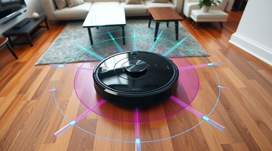
Robot vacuum mapping is built on sensors, software, and path planning working together in real time. During early runs, the device scans rooms, identifies obstacles, and turns raw data into a usable floor plan. SLAM helps it track position while it updates the map as conditions change. Yet the process is not always exact, and mapping errors can alter performance in ways that matter.
What Is Robot Vacuum Mapping?
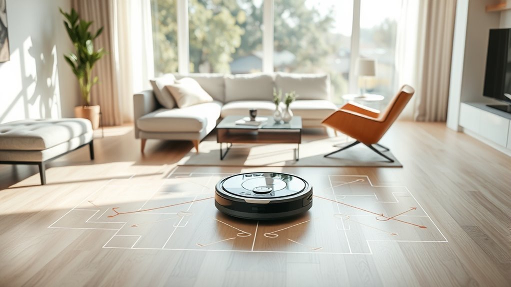
Robot vacuum mapping refers to the creation of a digital floor plan during an initial cleaning cycle, in which the device identifies walls, furniture, and other obstacles to define the home’s layout.
This robot vacuum mapping process uses advanced mapping technology, including LiDAR and cameras, to build a digital map that supports navigation technology and efficient cleaning. Instead of random motion, the machine follows systematic cleaning routes shaped by spatial data, reducing wasted time and improving coverage.
Advanced mapping technology like LiDAR and cameras helps robot vacuums clean efficiently with systematic, data-driven routes.
The resulting map can be edited in an app, allowing users to customize maps by merging or splitting rooms and setting no-go zones to preserve autonomy over private areas. Mapped units may store multiple layouts, which helps them adapt when furniture shifts or rooms change.
In practical terms, the system converts the home layout into a navigable model, enabling precise movement, consistent performance, and more controlled use of domestic space.
How Does Robot Vacuum Mapping Work?
During an initial cleaning run, a robot vacuum uses LiDAR, cameras, and other sensors to scan the environment and generate a detailed digital map of the home. SLAM algorithms fuse mapping data with navigation to locate walls, furniture, and obstacles while the Robot moves. The result is systematic cleaning paths that reduce missed areas and support autonomous freedom from repetitive labor.
| Element | Function |
|---|---|
| LiDAR | Measures distance for layout mapping |
| Cameras | Support object recognition and scene detail |
| SLAM | Synchronizes position with the digital map |
Advanced models, including eufy systems with 3D MatrixEye 2.0 and CleanMind AI, improve object recognition and route precision. Users can define virtual no-go zones in an app or place boundary strips to protect pet bowls and fragile items. Continuous learning then updates the home map as the environment changes, preserving efficient, adaptive cleaning over time.
Which Sensors Do Robot Vacuums Use?
Robot vacuums typically rely on LiDAR and camera sensors to measure distances, identify obstacles, and construct navigable maps of a room.
LiDAR provides precise spatial data, while cameras improve object recognition and performance under varying environmental conditions.
Infrared and cliff sensors add collision and fall detection, supporting safer movement across floors and around edges.
LiDAR And Camera Sensors
Most robot vacuums rely on a blend of LiDAR and camera sensors to build accurate maps of their surroundings and improve navigation. LiDAR delivers precise distance measurement and 360-degree mapping technology, even in darkness, while camera sensors identify furniture and obstacles. Together, these navigation systems support obstacle avoidance and route planning.
| Sensor | Function | Effect |
|---|---|---|
| LiDAR | Laser-based ranging | Detailed spatial map |
| Cameras | Visual recognition | Object classification |
| Hybrid systems | Combined sensing | Advanced mapping |
| Robot vacuums | Automated motion | Improved cleaning efficiency |
| AI modules | Scene interpretation | Better freedom from manual control |
Hybrid systems increase map fidelity, reduce collisions, and optimize coverage. Advanced models such as eufy X10 Pro Omni extend this logic with CleanMind AI and 3D MatrixEye 2.0, strengthening adaptive mapping across complex rooms.
Infrared And Cliff Sensors
Infrared sensors and cliff sensors add a critical safety layer to robot vacuum navigation. Infrared sensors support the obstacle avoidance system by detecting furniture, walls, and other obstructions, allowing navigation systems to preserve efficient cleaning paths.
Cliff sensors monitor floor edges and stairs, preventing dangerous drops and protecting the machine during movement. Working with LiDAR and cameras, these smart sensors improve mapping accuracy while maintaining real time responsiveness.
This sensor fusion enables the robot to adapt cleaning route decisions instantly when room layouts change or hazards appear. The result is a more systematic traversal pattern, reducing missed areas and unnecessary contact.
For users seeking autonomy in domestic labor, these sensors strengthen control, reliability, and spatial awareness across varied home environments without compromising safety.
How Does SLAM Create a Floor Plan?
SLAM creates a floor plan by combining sensor-based environmental scanning with continuous self-localization, allowing the robot to build and update a digital map in real time.
Using onboard sensors, including LiDAR and cameras, SLAM detects walls, furniture, and obstacles, then records them in memory as spatial references.
Algorithms process these data streams to create a coherent floor plan and determine the robot’s position within it. This structure lets the system optimize navigation, generate efficient cleaning paths, and favor systematic cleaning patterns over random motion.
As movement continues, continuous updates refine the real-time digital map, preserving accuracy when objects shift or rooms change.
The result is a controlled mapping process that reduces wasted coverage and supports consistent, autonomous cleaning performance.
How Do Robot Vacuums Avoid No-Go Zones?
Robot vacuums avoid no-go zones by combining boundary detection with map-based navigation controls.
In practice, robot vacuums use boundary strips made of magnetic material, and onboard sensors register these limits before crossing. LiDAR and camera-based sensors continuously compare real-time position against the floor map, allowing precise navigation around no-go zones.
Users may also define virtual walls in the eufy Clean app, which translates restricted areas into digital commands. Many models further permit drawing no-go zones directly on the saved map, giving granular control over where the machine may operate.
This mapping discipline protects furniture and pets while preserving open access to approved spaces. By excluding blocked regions, the robot concentrates on reachable areas, improving cleaning efficiency and reducing unnecessary travel.
The result is a more autonomous system with fewer interruptions, less manual intervention, and higher user satisfaction for households seeking reliable, controlled cleaning.
How Do You Create and Save a Home Map?
Creating and saving a home map begins with preparing the environment for a clean scan: obstacles should be removed, and doors to all intended mapping areas should remain open before the process is started in the app.
During robot vacuum mapping, the unit uses sensors to create a map and build a digital map of the accessible layout, then returns to its start point when the run ends. Accurate map creation depends on leaving the robot and, where relevant, the Omni Station stationary.
During robot vacuum mapping, sensors build a digital layout of the accessible area before returning to the start point.
- Start mapping from the app to create a map.
- Let the robot complete the full scan uninterrupted.
- Save the home map after the run finishes.
- Edit the saved map to merge, split, or label rooms for better cleaning efficiency.
On supported models, Multi-Map Saving preserves separate layouts for different floors or zones. This gives users more control over movement and scheduling, reducing reliance on manual intervention while keeping the system organized.
What Causes Robot Vacuum Mapping Problems?
Robot vacuum mapping problems commonly arise from low-light conditions and reflective surfaces, which can degrade camera-based sensing and produce inconsistent spatial data.
Dynamic layout changes, including moved furniture and temporary obstructions, further disrupt map accuracy by altering the robot’s reference environment during scanning.
Reliable mapping depends on stable conditions and sensor systems that can compensate for these variables.
Low-Light and Reflective Surfaces
Low-light conditions can greatly disrupt camera-based robot vacuum mapping because these systems depend on visible light to recognize objects and build accurate navigation data. In camera-based mapping, reduced illumination degrades object recognition, lowers accuracy, and increases navigation errors.
Reflective surfaces such as glass or polished floors can also produce false visual returns, confusing path planning and boundary detection.
- LiDAR improves distance measurement in darkness.
- Hybrid mapping systems combine LiDAR and cameras.
- AI enhancements refine mapping under poor lighting.
- Reflective surfaces can distort perceived room geometry.
These methods preserve autonomy and operational freedom by reducing dependence on ambient conditions.
Modern systems that fuse sensor inputs generally map more reliably than vision-only units, especially where lighting is unstable or surfaces are highly reflective.
Dynamic Layout Interference
Dynamic layout interference arises when furniture is moved, objects are added, or clutter changes the physical arrangement of a room, disrupting a robot vacuum’s pre-existing map and forcing it to re-evaluate navigation paths. In robot vacuums, sensors detect obstacles, yet mapping systems can still lose accuracy under rapid environment changes.
| Factor | Effect |
|---|---|
| Furniture shifts | Remapping needed |
| Added objects | Navigation errors |
| Clutter buildup | Missed zones |
| AI algorithms | Partial adaptation |
| Real-time mapping | Better correction |
Advanced AI algorithms improve resilience, but larger changes may still require manual map resets. Frequent rearrangement reduces cleaning efficiency and can trigger repeated passes or skipped areas. Regular obstruction checks support stable navigation, preserve mapping accuracy, and let users maintain autonomous cleaning with less constraint and more freedom.
Which Mapping Features Matter Most?
The most important mapping features are those that improve navigation accuracy and user control: LiDAR and camera-based systems typically produce the most precise digital maps, which in turn support more efficient cleaning paths and fewer missed areas.
Among mapping technologies, robot vacuums with mapping should create a digital map that enables Smart Navigation, advanced navigation, and strong mapping accuracy. Real-time updates matter because floor plans shift as furniture moves, and adaptive systems reduce blind spots.
Robot vacuums with mapping create digital maps for smart navigation, accurate routes, and fewer blind spots.
Multi-Map Saving is valuable in multi-floor homes, preserving distinct layouts without manual reconfiguration. No-Go Zones provide direct spatial authority, allowing restricted areas to be excluded through app controls or boundary strips.
User customization further improves utility by letting operators merge rooms, split zones, and add furniture markers, aligning the map with actual use.
- Precise sensing improves coverage
- Persistent maps support autonomy
- Editable layouts increase user control
- Adaptive updates maintain efficiency
Frequently Asked Questions
How Many Times Does Roomba Need to Map?
Roomba typically needs one to three mapping passes. Mapping accuracy improves through obstacle detection, room recognition, and mapping technology, but mapping limitations, battery life, user preferences, mapping updates, and app integration can affect cleaning efficiency.
Which Robot Vacuum Has the Best Mapping System?
Narwal Freo Z10 Ultra appears best, its mapping technology sketching rooms like a satellite. It leads in navigation accuracy, room recognition, obstacle detection, app integration, custom zones, cleaning efficiency, battery life, user reviews, maintenance tips.
How Long Does It Take for a Robot Vacuum to Map Your House?
Typically, mapping takes 30 minutes to several hours. Initial setup depends on sensor technology, mapping speed, and mapping accuracy; room recognition, layout optimization, cleaning efficiency, software updates, user experience, and mapping limitations shape duration.
Do All Robot Vacuums Map Your House?
No—practically a cosmos apart, not all robot vacuums map houses. Basic models use simple navigation; advanced units add mapping technology, navigation accuracy, smart features, obstacle detection, floor types, cleaning efficiency, user preferences, app integration, maintenance tips, mapping updates.
Conclusion
To summarize, robot vacuum mapping combines LiDAR, cameras, and SLAM to build accurate floor plans and guide efficient cleaning. The system enables obstacle detection, no-go zone avoidance, and map customization through connected apps. Although mapping can be disrupted by low light, clutter, or layout changes, continuous sensor refinement improves performance over time. When the technology works well, it delivers near-orchestrated navigation, transforming routine floor cleaning into a remarkably precise autonomous process.